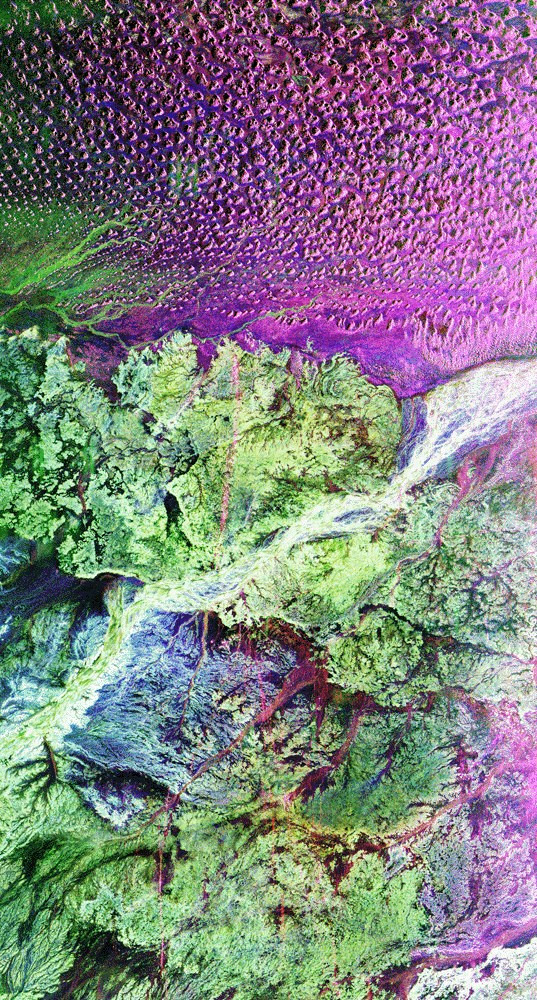
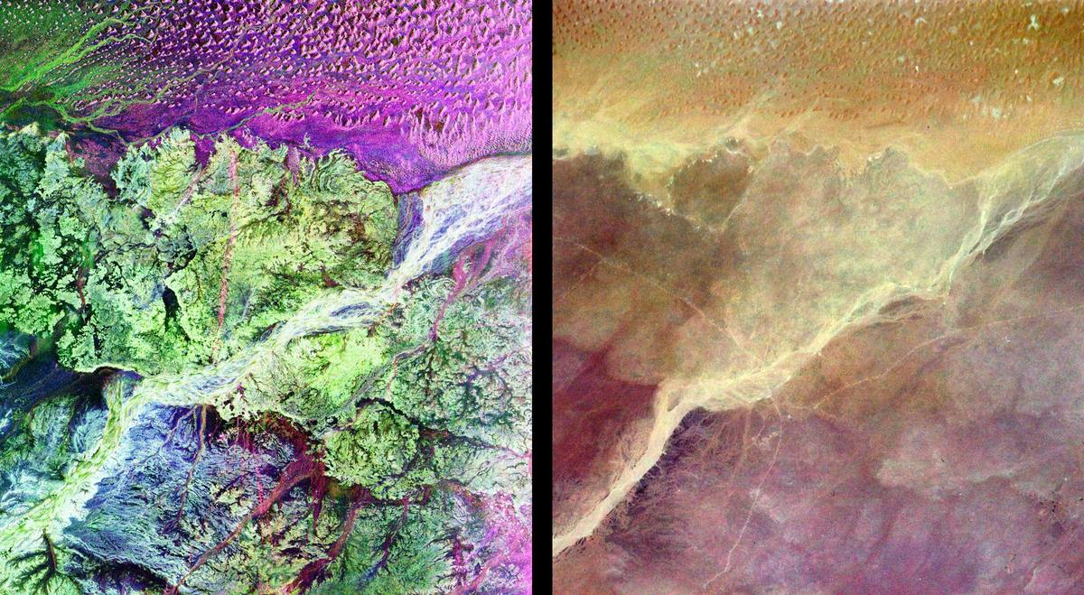
The evidence: Space shuttle radar image of the Ubar region

Ubar: The 'Atlantis of the Sands' Found From Space?
Last reviewed Next review
We review and update every article weekly. When the record changes, so does the article. How we review
In 1992 a team guided by space shuttle radar dug up a desert fortress in Oman and called it Ubar, the lost 'Atlantis of the Sands.' Was it really?
Verdict: Space radar really did help find a lost frankincense fortress at Shisr, but whether it is the Ubar of legend, rather than one trading post of the Ubarite people, has never been proven.
Sources NASA JPL news release 1992-1420 (5 Feb 1992); Los Angeles Times, Thomas H. Maugh II (5 Feb 1992); NASA Technical Reports Server, 'Finding the Lost City'; NOVA (PBS) interview with Juris Zarins (Sep 1996); NASA Earth Observatory, Pola Lem (7 Aug 2017); UNESCO World Heritage Centre, 'Land of Frankincense'; Qur'an 89:6–8 (quran.com)
For centuries Ubar was a place you could only read about. Arabian legend tied it to the people of ‘Ad and to Iram, a rich oasis that was destroyed for its wickedness. The Qur’an asks, “Have you not considered how your Lord dealt with ‘Aad, [with] Iram, who had lofty pillars, the likes of whom had never been created in the land?” Later, The Thousand and One Nights added to the story. T. E. Lawrence called it “the Atlantis of the sands.” The British explorer Bertram Thomas looked for it along the old trade routes in the 1930s and never found it. Many scholars doubted it had ever existed.
A phone call to NASA
The modern search began with Nicholas Clapp, a Los Angeles documentary filmmaker who had read about Ubar in Thomas’s book Arabia Felix. According to NASA’s Earth Observatory, in 1983 he called the Jet Propulsion Laboratory and asked for someone who could help him find a lost city. (JPL’s own 1992 news release dates his first contact to 1981.) He was put through to geologist Ron Blom, and then to Charles Elachi, who ran the Shuttle Imaging Radar-B project. “Okay, let me get this straight: You want to use my spaceship to find your lost city?” Clapp remembers Elachi saying.
Elachi agreed to point the radar at Oman as a side target. When the space shuttle Challenger flew in October 1984, a faulty antenna cut the mission short, and at first it seemed the Ubar images were lost. Then, in spring 1985, Blom opened an envelope and found that one data take had caught some of the landscape Clapp wanted. Radar can see a short way into dry sand. Over the next years Blom, Elachi and JPL geologist Robert Crippen combined it with images from Landsat 5, the French SPOT satellite and a shuttle camera. “I was surprised to find that we were able to readily detect ancient tracks,” Blom said in 1992. The tracks had been packed hard by the passage of countless camels, and some ran straight under large dunes, which showed they were old.
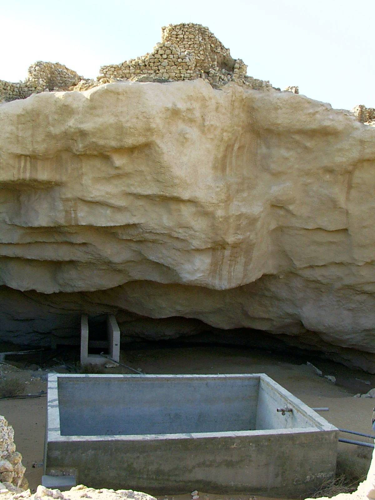
The well at Shisr
The images guided ground trips in summer 1990 and fall 1991, with archaeologist Juris Zarins, lawyer George Hedges and explorer Sir Ranulph Fiennes. The tracks met near Shisr, a remote well on the edge of the Empty Quarter. Thomas had stopped there decades earlier and noted a “rude fort,” which locals told him was only about 300 years old. The team found that the fort had been built on top of much older rubble.
Digging began in December 1991. In two months the team and volunteers moved about 200 tons of sand. On 5 February 1992 they announced that they had found Ubar. The Los Angeles Times reported a fortress with walls and towers at its corners, pottery from across the ancient world, incense burners and coins. Part of the fortress had fallen into a sinkhole. The team’s explanation was that the city had been built over a limestone cavern, and the cavern gave way. Clapp later wrote that the well had slowly drained over the centuries, weakening the rock, and that a small earthquake may have cracked it. “As in its myth, the city had sunk into the sands,” he wrote.
Doubts
The announcement went further than the evidence. A NASA technical summary of the find said it would “take time to validate the city as Ubar.” The sources don’t even agree on dates. JPL’s release spoke of a trading hub going back to 3000 B.C. NASA’s radar image caption gives about 2800 B.C. to A.D. 300. The Earth Observatory says Ubar rose about 2,000 years ago and fell between A.D. 300 and 500.
The people who found it have softened the claim. In 1996 Zarins told NOVA that in the classical and Arab sources Ubar means a region and a people, not one town. Ptolemy’s map marks the “Iobaritae.” In his view the city idea came from late medieval versions of The Thousand and One Nights, and Shisr was “one of probably three or four major centers.” In 2017 Clapp told NASA, “There was never any 100 percent proof, but we had pretty much all we could get without finding an inscription.” Blom was blunter: “Taking a flinty-eyed look at it, we just don’t know.” The site was smaller than the city of legend and was more likely a trading post, though he called it “the most significant archaeological site in that area.”
What nobody disputes is that the site is real and important. UNESCO lists “the caravan oasis of Shisr/Wubar” as part of the Land of Frankincense World Heritage property, along with the frankincense trees of Wadi Dawkah and the ports of Khor Rori and Al-Baleed. It describes Shisr as a fortified oasis about 180 km north of Salalah and a key water stop on the routes that carried frankincense to the coast. Blom thinks the trade there faded because frankincense mattered less once the Roman Empire turned Christian, the desert water table kept falling, and sea transport became reliable.
Sources
- NASA Jet Propulsion Laboratory, “JPL Technology and Expertise Key Role in Lost City Discovery”, release 1992-1420 (5 Feb 1992): jpl.nasa.gov
- Thomas H. Maugh II, “Ubar, Fabled Lost City, Found by L.A. Team”, Los Angeles Times (5 Feb 1992): latimes.com
- NASA Technical Reports Server, “Finding the Lost City”: ntrs.nasa.gov
- NOVA (PBS), “Lost City of Arabia”: interview with Dr. Juris Zarins (Sep 1996): pbs.org
- Pola Lem, “Peering through the Sands of Time: Searching for the Origins of Space Archaeology”, NASA Earth Observatory (7 Aug 2017): science.nasa.gov
- UNESCO World Heritage Centre, “Land of Frankincense” (English, French, Arabic and other languages): whc.unesco.org
- Qur’an, Surat al-Fajr 89:6–8 (Arabic text with English translation): quran.com
Original text. Images: NASA/JPL radar image (public domain) and photographs released into the public domain by their author, self-hosted. Every image on this page is credited where it appears.
Weighing it
The space-age part of this story holds up. Shuttle radar and satellite images really did show old caravan tracks, and they led a team to a real fortress buried at a desert well, which UNESCO now protects. What is still open is the name. No inscription says “Ubar,” the dates in the record don’t agree, and the expedition’s own archaeologist says Ubar was a people and a region, not a single town. Our reading is that Shisr was very likely an important Ubarite center, but not proof that the legendary city existed as a single place. The map pin is set at the level of the wider desert region, not the fenced site.
Verdict
Disputed Space radar really did help find a lost frankincense fortress at Shisr, but whether it is the Ubar of legend, rather than one trading post of the Ubarite people, has never been proven.
Evidence ledger
Each claim in this file, the source it rests on, and how well it holds up: 4 corroborated · 1 disputed. What the labels mean.
| Claim | Source | Type · date | Status |
|---|---|---|---|
| Ubar, linked with the people of 'Ad and with Iram, appears in Arabian legend and the Qur'an as a rich place destroyed for its wickedness; T. E. Lawrence called it 'the Atlantis of the sands'. | Qur'an 89:6–8; Los Angeles Times (1992); NASA Earth Observatory (2017) | primary record · 1992; 2017 | corroborated |
| Shuttle Imaging Radar-B on Challenger (October 1984), plus Landsat 5, SPOT and shuttle camera images, revealed old caravan tracks in southern Oman that converged near the Shisr well. | NASA JPL release (5 Feb 1992); NASA NTRS; NASA Earth Observatory (2017) | official · 1992; 2017 | corroborated |
| Digging at Shisr from December 1991 exposed a walled fortress with corner towers, sitting partly collapsed into a sinkhole, with pottery from across the ancient world. | Los Angeles Times (1992); NASA JPL release (1992); NASA Earth Observatory (2017) | press · 1992; 2017 | corroborated |
| The Shisr fortress is the lost city of Ubar itself.Zarins says Ubar was a region and people; Blom says 'we just don't know'; no inscription names the site. | Expedition announcement (1992); later doubts from Clapp, Blom and Zarins | secondary · 1992–2017 | disputed |
| Shisr was a fortified caravan oasis on the frankincense routes and is now part of the UNESCO 'Land of Frankincense' World Heritage property. | UNESCO World Heritage Centre | official | corroborated |
Update log
-
We added this case file.
-
Weekly re-check of sources; no change to the record since filing. Next check November 9, 2026.
Discussion
Discuss this case on the on-site Community board — no GitHub account required. Prefer a private tip for the editorial team? Submit a Sighting.
House rules: Community guidelines.