Feature reference (not a verified entrance)
Moynaq ship graveyard
Last reviewed: not yet Next review
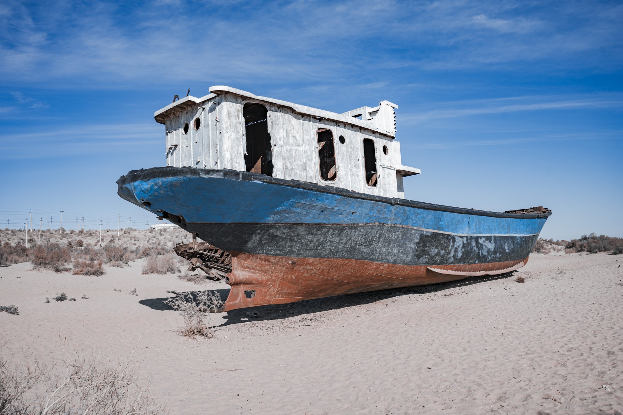
Rusting fishing boats stranded on sand where the Aral Sea used to be, a ship graveyard now some 150 km from the water.
Access
We haven't checked access for this place. Check the land manager's or local tourism site for hours, fees and closures, and stay off private or closed land.
Safety & respect
Ghost towns can have open shafts, unstable buildings and no services. Stay on public roads and paths, enter nothing that's fenced or posted, and take nothing.
Lore note
Moynaq was Uzbekistan's only seaport and a busy fishing and canning town. Soviet irrigation schemes from the 1960s diverted the rivers that fed the Aral Sea, which shrank so far that the shore now lies around 150 km away across the new Aralkum Desert. The rusting hulls of the fishing fleet were left on the old seabed beside the Aral Sea Memorial, and the ship graveyard now draws disaster tourists and an annual music festival.
Map links
Official / public map link · Approx. 43.7885, 59.0341: feature coordinate, not a checked entrance · Pin source: OpenStreetMap feature for the ship cemetery (Kemeler qábristanı) at Moynaq, cross-checked against the photo's GPS (within 0.2 km). The Wikidata point for Moynaq is the town centre, about 2.4 km away
Sources
- Wikipedia, Moynaq (CC BY-SA 4.0; read 12 Nov 2026): https://en.wikipedia.org/wiki/Moynaq
- Wikidata, Q750989 (coordinate location P625, country P17; read 12 Nov 2026): https://www.wikidata.org/wiki/Q750989
- OpenStreetMap, Kemeler qábristanı, Moynaq (read 12 Nov 2026): https://www.openstreetmap.org/search?query=Kemeler%20q%C3%A1bristan%C4%B1
Moynaq was Uzbekistan’s only seaport and a busy fishing and canning town. Soviet irrigation schemes from the 1960s diverted the rivers that fed the Aral Sea, which shrank so far that the shore now lies around 150 km away across the new Aralkum Desert. The rusting hulls of the fishing fleet were left on the old seabed beside the Aral Sea Memorial, and the ship graveyard now draws disaster tourists and an annual music festival.
This entry is part of our world atlas. The summary above is written in our own words from the Wikipedia article, and the map pin uses published coordinates cross-checked against Wikidata. We haven’t visited this place or checked current access.