Feature reference (not a verified entrance)
BP Impact Structure
Last reviewed: not yet Next review
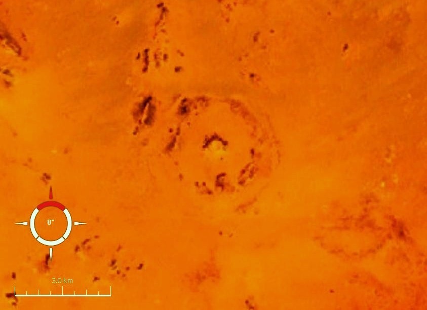
An impact crater in Libya.
Access
We haven't checked access for this place. Check the land manager's or local tourism site for hours, fees and closures, and stay off private or closed land.
Safety & respect
Craters are often remote, with rough tracks and no shade or water. Tell someone your plans and don't collect rocks where it's forbidden.
Lore note
The BP Impact Structure, also known as Gebel Dalma, is a deeply eroded impact structure that is located 165 km (103 mi) northeast of the Kufra Oasis in southwest Libya. The BP Impact Structure consists of three, discontinuous, concentric ridges that rise above the surrounding desert plain. These prominent, ridges consist mainly of deformed sedimentary rocks, e.g.
Map links
Official / public map link · Approx. 25.3194, 24.3094: feature coordinate, not a checked entrance · Pin source: Wikipedia article coordinates, cross-checked against Wikidata Q795177 P625 (within 2 km)
Sources
- Wikipedia, BP Impact Structure (CC BY-SA 4.0; read 1 Nov 2026): https://en.wikipedia.org/wiki/BP_Impact_Structure
- Wikidata, Q795177 (coordinate location P625, country P17; read 1 Nov 2026): https://www.wikidata.org/wiki/Q795177
The BP Impact Structure, also known as Gebel Dalma, is a deeply eroded impact structure that is located 165 km (103 mi) northeast of the Kufra Oasis in southwest Libya. The BP Impact Structure consists of three, discontinuous, concentric ridges that rise above the surrounding desert plain. These prominent, ridges consist mainly of deformed sedimentary rocks, e.g.
This entry is part of our world atlas. The summary above is adapted from the Wikipedia article (CC BY-SA 4.0), and the map pin uses the coordinates published there, cross-checked against Wikidata. We haven’t visited this place or checked current access.